ST. GEORGE — Like the character Ross says on the classic TV show “Friends,” what is now Tropical Storm Hilary is “on a break” as far as Southern Utah is concerned.
That doesn’t mean the storm isn’t going to still pack the whallop later Sunday that forecasters have been predicting since Friday.
And there is now an additional worry the National Weather Service has for the Cedar City area: High winds of up to 70 mph. A high wind warning, meaning high winds are imminent or occurring, has been issued by the National Weather Service for the Cedar City area as well as Enterprise, Parowan and Beaver County from 11 p.m., Sunday night to 3 p.m., Monday.
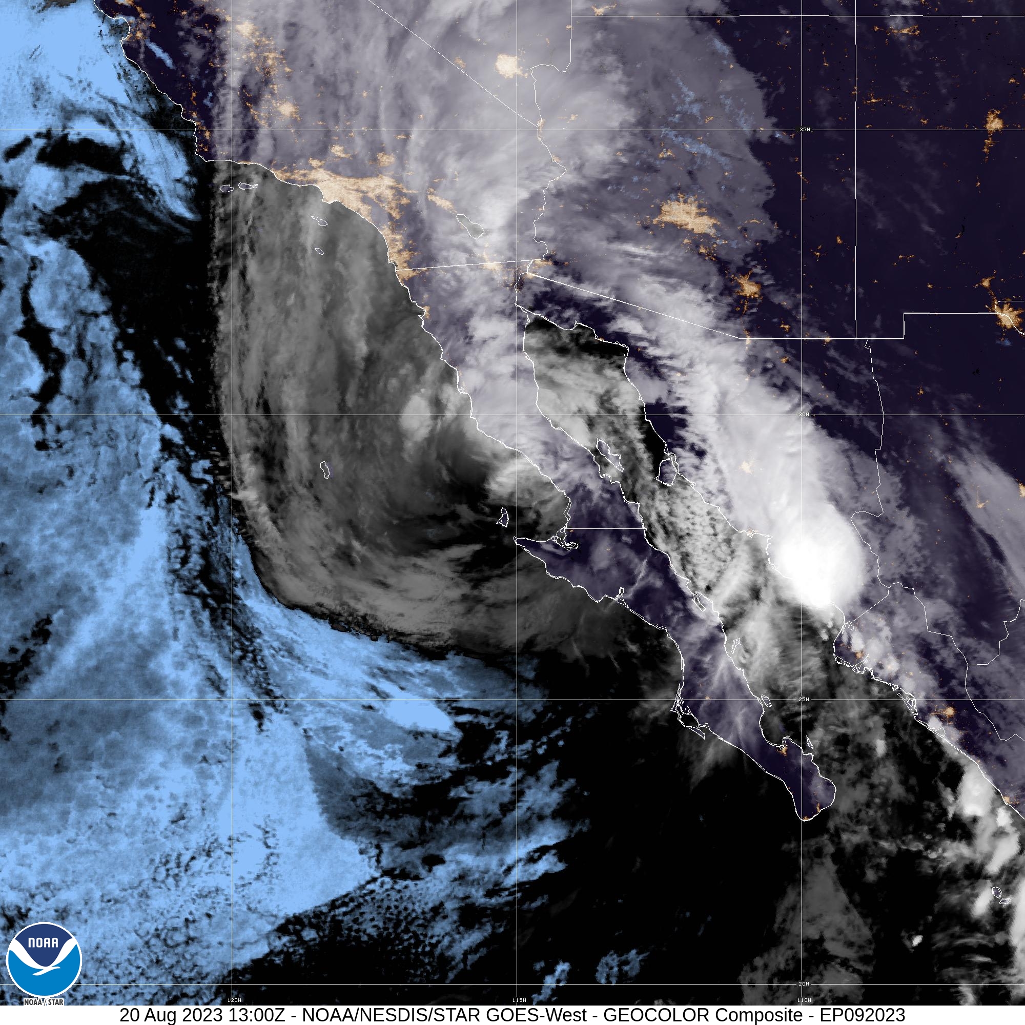
As of Sunday morning, Hilary has — as expected — been downgraded to a tropical storm after dumping flooding rain and hurricane-force winds on the western coast of Baja California. As of 9 a.m., the center of the storm was about 200 miles south of San Diego with sustained winds of 70 mph.
The current forecast track has the center arriving in San Diego and Los Angeles as a tropical storm with winds of that speed then cutting a path through Southern California’s Inland Empire and crossing Interstate 15 in Barstow.
The National Hurricane Center is still using the words “catastrophic and life-threatening flooding” to describe what is predicted for the southwestern United States on Sunday afternoon — from Southern Utah to Southern California.

“This is a break. We’ve been expecting this,” Christine Cruse, of the weather service’s Salt Lake City office, told St. George News on Sunday morning. “Were expecting the heavy rain after 2 p.m. in St. George and Cedar City. People need to stay tuned for announcements.”
Cruse reiterated that this is “not a great day to be in the local slot canyons.”
She also mentioned that while the possibility of local tornadoes remains “very small,” it has been upgraded from 1% to 2%.
Something new that residents of Iron County need to be ready for, according to Cruse, are very high winds after midnight on Sunday, Aug. 20. She said another weather disturbance is going to combine with Hilary to produce winds of up to 70 mph in Cedar City with sustained winds of at least 35 mph.
“People in Cedar City should make sure they don’t have anything that can be taken by the wind, like trampolines and decorations,” Cruse said.
Copyright St. George News, SaintGeorgeUtah.com LLC, 2023, all rights reserved.