ST. GEORGE — A wet weekend is expected for Southern Utah as heavy rains drench the valleys and snow accumulates in the mountains. Flood preparation is underway in certain municipalities as a result.
The National Weather Service in Salt Lake City issued a hazardous weather outlook and a winter weather advisory Friday through Sunday affecting Beaver, Iron, Washington, Kane and Garfield counties.
Affected areas
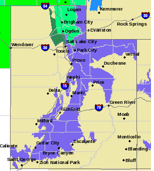
While the advisory is in effect for the entire western two thirds of the state, regionally impacted areas include southwest Utah, Utah’s Dixie and Zion National Park, south-central Utah, Glen Canyon Recreation Area-Lake Powell and southern mountains.
Heavy rain and potential flooding
Heavy rain and high elevation snow will spread from north to south across the outlook area Friday night.
Rain and melting snow will lead to potential flooding from ponding of water in low lying and poorly drained areas across portions of northern Utah where there is still snow in the valleys. Heavy rain could impact drainages across much of the area, especially in Southern Utah.
Snow levels will start to lower Friday across the north then through the night and into Saturday across central and southern areas. Winter driving conditions will spread south and will eventually impact travel on most routes above the valley floors across the outlook area tonight into tomorrow.
The flood threats will remain through Saturday.
Precipitation will taper off from the north on Saturday but could linger across the south into Saturday night and possibly into Sunday.
Gusty northerly winds are possible near canyons across Southern Utah Saturday night into Sunday.
Snow in the mountains
In the southern and central mountains, rain and snow early Friday evening will turn to all snow and become heavy at times late this evening through Saturday morning. Snow will gradually taper off Saturday afternoon.
Snow levels will reach elevations of around 7,000 feet late Friday evening.
Travel impacts
Significant travel impacts due to accumulating snow are expected along all routes above 7,000 feet. Portions of I-70 through the central mountains may see areas of snow or slush on roadways during this advisory. The greatest impacts will be late Friday night through Saturday morning.
Flood preparation

Enterprise2day reported that the City of Enterprise has been proactive in planning for potential flooding. Over 30,000 sandbags are at the ready should floodwaters become a problem.
The city is recommending residents make sure their borrow pit areas are clean to allow water to flow freely.
Turn around. Don’t drown.
Flash flooding is a very dangerous situation. The National Oceanic and Atmospheric Administration and the National Weather Service offer the following safety rules for flash flooding:
- Flash flood waves, moving at incredible speeds, can roll boulders, tear out trees, destroy buildings and bridges and scour out new channels. Killing walls of water can reach heights of 10-20 feet. You will not always have warning that these deadly, sudden floods are coming. When a flash flood warning is issued for your area or the moment you first realize that a flash flood is imminent, act quickly to save yourself. You may have only seconds.
- Most flood deaths occur in automobiles. Do not drive your vehicle into areas where the water covers the roadway. Flood waters are usually deeper than they appear. The road bed may not be intact under the water. Just 1 foot of flowing water is powerful enough to sweep vehicles off the road. If the vehicle stalls, abandon it immediately and seek higher ground. Rapidly rising water may engulf the vehicle and its occupants and sweep them away.
- Do not hike rivers and especially slot canyons while flash flood warnings are in place.
- Do not hike alone, and always tell someone where you and your buddy and others are going.
- Get out of areas subject to flooding, including dips, low spots, canyons and washes.
- Avoid already flooded and high velocity flow areas. Do not try to cross a flowing stream on foot where water is above your knees.
- Be especially cautious at night when it is harder to recognize flood dangers.
- Do not camp or park your vehicle along streams and washes, particularly during threatening conditions.
During any flood emergency, stay tuned to your NOAA weather radio, commercial radio or television. Follow St. George News at STGnews.com and St. George News Facebook for weather alerts and updates relevant to Southern Utah. Information from the National Weather Service and disaster and emergency services may save your life.
Resources
Email: [email protected]
Twitter: @STGnews
Copyright St. George News, SaintGeorgeUtah.com LLC, 2017, all rights reserved.