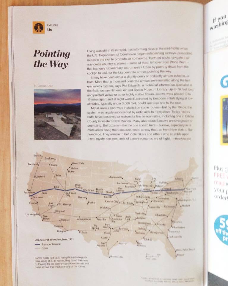
ST. GEORGE – Three Southern Utah landmarks dating back to the 1920s are grounded in American aviation history. In Episode 39 of the “No Filter Show,” Co-hosts Paul Ford and Grady Sinclair head out to one of them – a large concrete arrow on the bluff overlooking the Bloomington area of St. George. The function of this arrow, and others like it, was to light the way for airmail planes traveling at night during the primitive days of aviation.
Read more: Washington County points the way from Salt Lake to L.A., 1920s navigational cement arrows
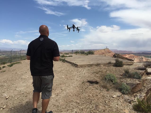
Photos of these historical arrows, captured by the lens of St. George News photographer and contributor John Teas, were featured in National Geographic this month, fulfilling Teas’ lifelong dream of seeing his work printed on the pages of that revered magazine.
Joining the “No Filter” guys at the site of the Bloomington arrow, Teas talks about these local landmarks, the role they played in history, and the honor of seeing his images in National Geographic. Get ready for takeoff … and roll tape!
Ed. note: National Geographic publishes different content in various regions. The story “Pointing the Way” may not appear in all editions.
Hit the play arrow  above
above
Related posts
-
Click here to see all the No Filter shows
- UFOs invade St. George Airport; STGnews Videocast
- Washington County points the way from Salt Lake to L.A., 1920s navigational cement arrows
- Grand Canyon designates 1956 TWA-United Airlines accident landmark
Instagram: NoFilter_STGnews
Email: [email protected]
Twitter: @STGnews
Copyright St. George News, SaintGeorgeUtah.com LLC, 2015, all rights reserved.
I came across a 1930 Navigational Chart that notes the locations of the concrete arrows in NV and Utah. Very cool indeed.
I hope the photographer and Nat Geo had FAA clearances to use the drone photography for commercial purposes; otherwise they are breaking the law.
“Duane Fielding flies a drone over the Bloomington aviation arrow”
If that is Duane Fielding of I-works/Jeremy Johnson infamy, he is no stranger to breaking the law.
Here’s a list of KNOWN arrows and beacons in the western US:
http://surveymarks.planetzhanna.com/airway-beacons-list-western-u-s/
For the Eastern US:
http://surveymarks.planetzhanna.com/airway-beacons-list-eastern-u-s/
There is also one across the freeway from the aircraft beacon, south of Mesquite.
Since they were supposedly ten miles apart, there should be two or three more between that beacon and the one in Bloomington.