SOUTHERN UTAH – The National Weather Service has issued a “Winter Storm Watch” for Washington, Iron, Kane, Garfield and Beaver counties, effective 7 p.m. Friday through 8 p.m. Sunday.
Affected area
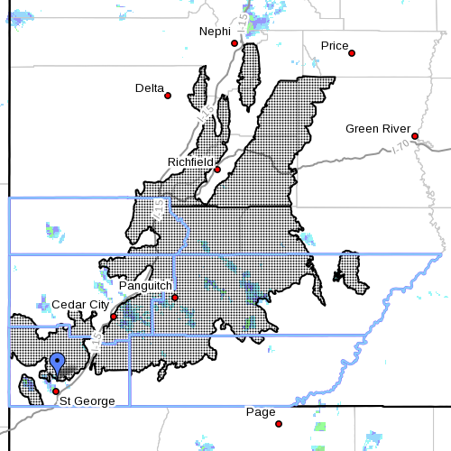
The central and southern mountains of Utah; watch includes the cities of Cove Fort, Koosharem, Fish Lake, Loa, Panguitch and Bryce Canyon.
Snow accumulations
Snow accumulations of 1 to 2 feet are expected in the affected areas.
Timing
The storm is anticipated to develop Friday night and continue heavy at times through the weekend.
Impacts
Winter driving conditions can be expected on area roadways, including the higher passes of Interstate 70 and Interstate 15, across central and southwest Utah.
Precautionary/preparedness actions
A “Winter Storm Watch” means there is potential for significant snow that may impact travel. Motorists planning to travel through the affected areas should continue monitoring the latest forecasts to obtain updated information.
Related posts
- 6 decades, no snow days: School district clocks 61 years without snow cancellation
- Storm brings snow, some accidents to Southern Utah; STGnews Photo Gallery, Videocast
- Power line fire knocks out power for New Harmony residents
Email: [email protected]
Twitter: @STGnews
Copyright St. George News, SaintGeorgeUtah.com LLC, 2015, all rights reserved.