UPDATE – Oct. 29, 9:41 a.m. – The National Weather Service has cancelled this Winter Weather Advisory. In its notice, it stated: Showers will continue at times through today and Wednesday. However accumulations are generally expected to be less significant than Monday. Another 2-4 inches of snow is possible in some mountain locations through the next 36 hours.
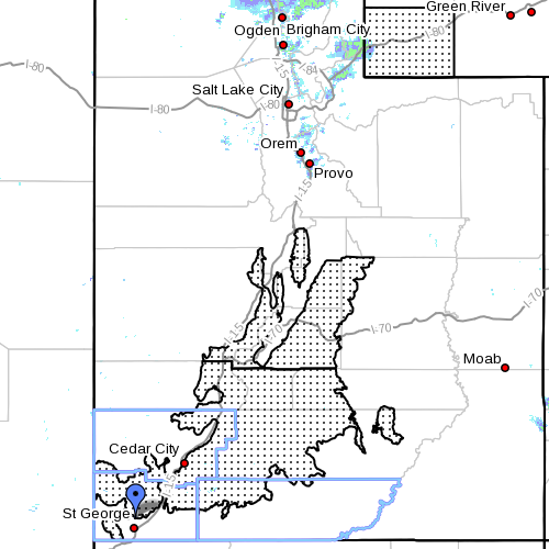
SOUTHERN UTAH – The National Weather Service has issued a “Winter Weather Advisory” for Washington, Iron and Kane counties, in effect until noon Tuesday.

Affected areas – The southern and central mountains of Utah, including the cities of Cove Fort, Koosharem, Fish Lake, Loa, Panguitch and Bryce Canyon.
Snow accumulations – New snow totals of 5-10 inches are expected by late Tuesday morning.
Timing – Snow at the highest elevations late this afternoon will become more widespread and locally heavy by early evening. This snow will continue overnight before tapering to showers Tuesday morning.
Winds – Winds will accompany the snow through early evening then diminish.
Snow levels – Snow levels will lower to around 6,000 feet this evening.
Impacts – Snow accumulation along with some blowing and drifting snow will impact travel this evening through tonight.
Precautionary/preparedness actions – A winter weather advisory means that snow accumulations will, primarily, cause travel difficulties. Be prepared for snow-covered roads. Use caution while driving.
Related Posts
- High winds uproot trees around SUU, knock out power
- Wind advisory for Washington, Iron, Kane counties
Email: [email protected]
Twitter: @STGnews
